Tuesday, February 16, 2016

Sydney: G’day, mate… it’s good to be back here.

We arrived in Sydney early on Saturday morning. It is a turnaround day – the last stop on one leg of our journey and the first stop on the next. We are losing about 100 passengers and gaining about the same number back.


Just to keep you aware of how big Australia really is, it is over 2500 miles from Sydney to Perth by air.


Sydney is one of the world’s most exciting cities. We were docked in the area noted as “Balmain”  and the picnic described later in this blog post was on Shark Island to the right.

It was a bittersweet day for us. We love Sydney and because of our earlier stays, we feel very comfortable getting around. However, we were also losing two of our friends who had just signed on for a short part of the trip, Rod and Margaret Kefford. Rod and Margaret live in Sydney, so I am reasonably sure we will see them again, perhaps in Florida as well as in Australia.


Fortunately, while on the ship, we were able to celebrate Margaret’s 65th and 66th birthdays in Le Champagne Restaurant along with another couple we all knew who are from Adelaide. Margaret is in the center and Rod is right behind her.

The cruise line has a special event prepared for the World Cruise passengers. We will be ferried out to an island in Sydney Harbor – Shark Island – where we will be treated to a barbecue lunch, demonstrations of native aboriginal skills and arts, and visits with some native Australians of the four-footed variety.

The day began with a transfer on a fast ferry out to the island with local commentary on the way as we made our way through Sydney’s very busy harbor. Bear in mind that because the city has grown around the harbor – possibly the largest and best natural harbor on earth – many people live on the north side (mostly residential and corporate headquarters) and ferry across to the downtown area to work. There are also many who live on the south side and do the opposite. Getting around the harbor is not a job for the faint of heart. One must navigate not only the water, but the ferries (public and private), the water taxis, the cruise ships, the freighters and tankers, the pleasure boats, and the fishermen. It is also a fantastic way to really see how Sydney lives and functions.


Our arrival on Shark Island.


Bonnie makes friends with just about everyone she meets – two-legged or four-legged…


This Wombat, a marsupial that looks like a giant rat, decided that he wanted to inspect me as I was crouching down to take this picture. He got up close and personal as he darted through my legs, unfortunately, we didn’t get a shot of that journey or of the expression on my face…

Shark Island, our destination, is called that because of its shape, not because of the proximity of any real sharks in the area. The island is a preserve and has been “bought” for the day by the cruise line for us to use. As we walked off the ferry, a line of servers stood waiting with tall flutes of champagne and orange juice for the teetotalers. We walked up a small hill to the center of the island where a large tent had been erected with linens, silver, and crystal. Behind the tent was a permanent gazebo that had been converted to a temporary kitchen and service line.

We were broken into several smaller groups and some of us were asked to begin lunch while the others were presented with a choice of learning about aboriginal art, aboriginal music and instruments, and aboriginal hunting skills. We were in the eating group.

The menu consisted of a variety of grilled local delicacies: steak, Balmain bugs (sort of lobster tails to the uninitiated), lamb chops, salads, wine, cheeses and fruit for dessert.


Here is the tent where we ate. We were serenaded by the string trio in the foreground.
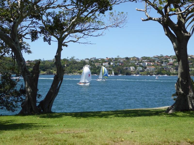


This shot of Nelson’s Bay from Shark Island gives you some idea of how Sydneysiders spend their weekends. Tough, huh!


Here is a shot of Botany Bay looking back toward downtown Sydney from Shark Island.

We then switched places with the other group and learned about the didgeridoo and the klackers. The didgeridoo is a hollow log the is used to make music by using the lips, teeth, breath, and sounds from the throat. It takes lots of practice just to make any sound come out. We also learned that the authentic instruments are made by termite ants that eat their way through the log and hollow it out. If you are ever in the market for a didgeridoo, stick your fingers inside it and make sure it is uneven and grooved on the inside. That way you will know it is authentic and not machine made. The klackers are small pieces of wood that are hit together to form a background rhythm to the chants and the didgeridoo. I learned all of this fascinating stuff from our guide and demonstrator, Yunbalayidinigoringigammaregeljadigal. His western name is: David Robert Barnett. I had asked him to spell his aboriginal name so I know that is correct. I hope I got the western name correct as well…


This is David explaining how sounds are made with the didgeridoo.


David demonstrated how the didgeridoo can be made to emulate animal sounds. Here he is doing an emu.

We also spent some time learning about aboriginal art. The native Australians have no written language. All lore is handed down verbally or through their paintings and symbology. Everything on an aboriginal painting has meaning. I just wish I had paid attention to some more of the detail so I could explain what we saw in more detail.

Finally, I spent a few minutes with another of the demonstrators as he described how the boomerang is used to disable or kill game for food. It is amazing how they can control the boomerang to cripple, kill, or just distract various animals. They do not believe in killing or maiming unless they plan to eat it. I tried to use a boomerang, but in my case it was just a curved stick…


A last look over Botany Bay before we left Shark Island. After our adventures on Shark Island, we ferried back to the ship and rested up for Sunday’s foray to Manly Beach.

Sunday morning, we caught the first ferry from the cruise ship terminal over to Circular Quay, the hub of Sydney’s waterfront. We were with another couple who we had met on the trip and the four of us decided to make it a day of wandering, stopping for lunch, and then back to base.


This map will give you some idea of where Manly is with respect to downtown Sydney and our ship. We are docked to the left of the bridge in the area called Balmain. Manly is way out at the far right just north of Sydney Harbor National Park. It is about a 30-minute ferry ride from Circular Quay to Manly Wharf.


This will give you more of an idea of what the attraction is at Manly. Bondi Beach, to the south on the Sydney mainland, may be famous for its surfing, but Manly is much more scenic and lively. We ferried to Manly Cove and walked over to the ocean side promenade where it is marked Manly Beach.

Manly is on the north side of Sydney Harbor and is the easternmost point of land between the harbor and the Pacific Ocean. The ferry pulls in on the bay side and a short walk through town gets you over to the beaches on the ocean side. Swimmers, surfers, bathers – sun and otherwise – all dot the beach and the water. We walked about a mile or so up the beachfront walk and strolled a local craft market on the way back through town. We found a restaurant for lunch near the bay side. After lunch we strolled the bay side for a while, then grabbed a ferry back to Circular Quay.


These two shots of the Manly Beach – one taken looking north and one looking south – provide a good idea of how clean, large, and used by all are the local beaches.


This panorama shot of the volleyball area also indicates how well-used the local beaches are.


On the bay side, the water is more subdued and much shallower. It is an excellent place for families with small children to get them used to the water. We saw kids as young as seven or eight learning to paddle-board and kayak!

The last ferry provided by the ship from Circular Quay to White Bay Cruise Terminal had just left. Our companions opted for a taxi back to the ship. We managed to get a ferry just pulling out that took us around to Darling Harbor. At Darling Harbor, we caught the ships shuttle bus back to the ship and collapsed! What a day: walking, shopping, people-watching, eating, boating (sort of).

Tomorrow we head out to Newcastle, New South Wales second largest city. Stay tuned…


Wednesday, February 10, 2016

Bay of Islands: New Zealand’s playground…

We had an interesting day in the Bay of Islands area of NZ. We did a wine tasting tour. The good news is that we got to taste over a dozen wines. The bad news is that we got to taste over a dozen wines.

First, some background on the Bay of Islands and the Paihia (pie-hee-ah) and Kerikeri (keri-keri) locales. This is an area of vacations, second homes, retreats, and quick getaways for a lot of New Zealanders as well as a draw for many visitors to NZ.
Bay of Islands locationBay of Islands
The two wineries we visited were Ake Ake at the top and Marsden Estaste on the bottom. You can see where we anchored (the red star) and the town of Paihia.

The port we are anchored off is Paihia. It is a small town reminiscent of the Cape Cod area. One of the major draws is the Waitaingi House. Waitangi House is where the Waitangi Treaty was signed and is one of NZ’s major hhistoric sights. Remember, Waitangi day is to NZ what July Fourth is to the USA.
P1000628
I took this shot from our veranda on the ship (with a 30 X zoom). That is One Tree Hill, the site of the signing of the Waitanga Treaty. It was signed in the small stone building. The white tent-like structure off to the side is the entrancer to the Waitangi Museum that just opened this weekend. That Norfolk Pine is not the original “one tree.” The original was knocked down many years aog and this one is a re-plant.

Our tour began with a short visit to a hill on a golf course next to the Waitangi Reserve, a national park. We had good views of the bay and the surrounding area.
P1000630
The view from the golf course. On the left is the Artania, formerly the Pacific Princess – not the Love Boat, but the ship that replaced the Love Boat. Our SIlver Whisper is to the right. What’s intersting is that while the Artania is about 20,000 tons larger than the Whisper, it holds almost four times as many passengers.

A short ride later, we pulled into the first winery on our tour: Ake Ake Vineyards. In Maori, “Ake” means “more” or “many.” Therefore, Ake Ake means quite a few, or a whole big bunch, or words to that effect. The winery owner is a transplanted Channel Islander and wanted to be known for being a part of his new home.

Ake Ake  vineyard, restaurant,  and winery is a small, bio-dynamic, organic vineyard making only several hundred cases of wine annually. Most of his wines are sold in the restaurant and at the “cellar door’’, the NZ and Aussie term for the tasting room. As I said above, unfortunately, although the owner, John, was delightful in his descriptions of his history and his winemaking, the wines were only passable. The best was a Sauvignon Blanc. The rest were, well, less than memorable. Although we tasted six wines, we had no desire to take a bottle with us.
P1000634
The winery owner getting ready to explain his wines to us.
P1000637
The view from the tasting room out to the vineyards, through the restaurant at Ake Ake Vineyards.
We then moved on to our next winery, Marsden Estate. Marsden is a well-known and respected name in NZ history – but not so much when it comes to wines (our personal opinion). We again tasted our way through about six or eight wines and none of them were very good. The good news is that Marsden put out a nice place of nibbles. Since we had not had any lunch (due to tender issues and timing of the tour), we eagerly went at it. The food was the best part of the tasting.
P1000646
Our platter of “nibbles” at Marsden WInery that became our lunch.
P1000645
The view from the tasting room at Marsden out to the vineyartds. That white covering over the vines is to protect the vines from the birds. They will eat all the ripe grapes if not covered.

I think that it is important to explain here that while NZ is known for some very fine wines – particularly Sauvignaon Blancs, none of them come from this far north on the North Island. It is just too hot and wet here to grow the quality of grapes that are required for fine wines. I believe that the locals enjoy it since it is, indeed, local wine. However, it is simply not wine that is worth traveling for or bringing halfway around the world. Having said that, we have had many really wonderful wines from the Hawkes Bay area and further south. Geographically, the difference is only a few hundred miles, but its like the difference between growing grapes in Napa Valley, CA and Anywhere, Florida.

After our tasting we made a stop at a honey factory – yes… This was just not any old honey, but it was Manuka honey. Manuka honey is said to have medicinal propertiers and several of our tour members wanted to stop and pick up some. OK, a honey stop.

We then drove through the town of Kerikeri (“keri” means “big” in Maori, but Kerikeri was not all that large…). In Kerikeri we stopped to visit the oldest stone building in NZ.

On the way back to the tender dock in Paihia, we stopped at a chocolate shop. Funny, we get all the sweets and really rich European chocolate you could ask for on the ship, but some people cannot pass a chocolate shop without stopping…you can usually pick therm out from behind quite easily…

Finally, back to the tender dock and catch the last tender out to the ship.

We now have a few sea days to get ready for Sydney and Australia. Stay tuned…

Tuesday, February 9, 2016

Auckland: possibly the friendliest city in the world…

We are back in Auckland for a day. Auckland is a delightful city, really more of a “town” than a city. It is compact enough that you don’t feel overwhelmed, but spread out over three peninsulas and several decent-sized islands that you can get away from it all – as if getting away from a lot to see and do, good food, and nice people needed getting away from at all…
Auckland map
Last time we were here we opted for a food tour around Auckland. It was then that we discovered just how charming the city and its people really are. Since we are here on a holiday weekend – don’t forget Waitangi Day and the fact that a weekend holiday requires a Monday closing – we probably won’t be able to see much downtown. Therefore, we chose to take a harbor ferry across to Devonport. Devonport is one of the original “towns” that were the precursors of modern Auckland. Devonport is a fifteen minute ferry ride across the harbor and a journey back to the late eighteenth and early nineteenth centuries.
P1000624
As we pulled in on the ferry, we began to see the charm of Devonport.
P1000609
On our arrival we stopped at the info center in the ferry terminal and picked up a brochure detailing “The Old Devonport Walk.” The brochure indicated that we could do the walk (about 3-4 miles) in about an hour. Brochures lie! We did do the entire walk, but to take a few moments to stop and look at the sights listed and take several of the short detours suggested took more than two hours. By that time we were famished and footsore.

As we walked from the ferry terminal to the beginning of our historic stroll around town, it was easy to see why Devonport remains a favorite of locals and visitors alike.
IMG_2105
At the beginning of our walk, we stopped to look back across the bay to Auckland.
P1000623
The Auckland skyline with the SkyTower in the center (people actullay bungee-jump off the top of this building!). To the left of the SkyTower is an office building dubbed by locals as the “toilet seat” building. Use your imagination…

A short stroll among the many small restaurants and bars led us to a cafe/bar serving fish and chips and NZ green-lipped mussels. We were home! Bonnie had the fish and chips and said it was among the best she had had in recent memory – fried just right. I had a huge bowl of green-lipped mussels in a Thai coconut sauce that was like no other I have ever had. Green-lipped mussels are quite unlike the smaller black mussels so common in Europe and the United States. The black mussels are usually about 2-3 inches long and it takes about 3-4 mussels to make up an ounce of mussel meat. The green-lipped mussels are about 6-7 inches long and each mussel inside weighs about 1-1 1/2 ounces. I must have had close to a pound of mussel meat by the time I got to sopping my two slices of the accompanying toasted French bread in the coconut sauce. YUM!

We wandered a bit more among the shops and restaurants – bought the obligatory kitchen magnet – and hopped the ferry back to Auckland. Although we sort of expected most specialty shops to be closed for the holiday, we took a short walk from the ferry terminal up Queen Street to see if “our” cheese and ice cream shop was open. Alas, it was not to be – but we did find it and the location is now imprinted on our memory for next time. I say our cheese and ice cream shop because the last time we were here, the food tour wound up with a cheese and ice cream tasting at this shop. The cheeses were wonderful and we discovered lemongrass and ginger ice cream. Oh well, next time.

Back on the Silver Whisper we wound down from a long day walking and eating and made ready for tomorrow in the Bay of Islands and some wine tasting. Stay tuned…

New Zealand: traveler’s paradise…

We are beginning a three-day stay in New Zealand. This time we will visit three cities on the North Island. We were fortunate to have visited NZ several years ago and had two wonderful weeks traveling from Milford Sound in the south island to Bay of Islands in the north island. . This year’s stay is much shorter, but still, any time you can get in NZ is good time.

This time around we will be in Tauranga, Auckland, and Bay of Islands. Yesterday, Saturday, was Waitangi (wye-tang-ee) Day. Waitangi Day celebrates the signing of the treaty that permitted the English explorers to settle in NZ. Here’s another interesting factoid for your Jeopardy! notebook: the Maori of New Zealand are the only indigenous people that were never conquered by colonialist nations. They signed the Waitangi Treaty in the 18th Century and have been at peace ever since. Do not believe that the Maori “gave up.” They are among the fiercest warriors in the world and could easily have defeated any invading force at the time, but their leaders believed that the treaty would guarantee their lands and customs. They were correct. The Maori and the Kiwis today not only live as peaceful neighbors, but many Kiwis have adopted much of the Maori culture and language in their everyday goings-on. As an aside, since this is Waitangi Day weekend, Tauranga and Auckland should be very lively.

Sunday we are docked in Tauranga, NZ’s third largest city. The Port of Tauranga is being improved and will soon be one of the largest ports in the south Pacific. Currently, it appears to be as large, if not slightly larger, than Port Everglades.
Tauranga map
One thing that immediately strikes you about landing in this busy industrial port is that it is clean. So clean that you begin to wonder if there is any activity here. Then you see the cranes, the cargo ships, and best of all, the pleasure boats. They all share the harbor and there is nothing out of place. You get the feeling that if someone dropped a piece of rubbish and didn’t pick it up, they would be immediately ostracized and given a good tongue-lashing for their transgression.

Since Tauranga is the gateway to one of the north island’s tourist hotspots – Rotorua (roto-roo-ah) and the Gates of Hell – and a somewhat lesser attraction, but almost as popular, that being “Hobbiton.” Hobbiton is the leftover set and back lot from the Peter Jackson film adaptations of the “Lord of the Rings” and the “Hobbit.” Many of our fellow passengers are excited about getting to see the actual sets and the backstage stuff. I must admit that getting a backstage tour is a lot of fun and we like sort of stuff, but we just can’t get our heads around the hoopla that accompanies Hobbition. Several years sago during our NZ tour we stopped in Taurange, boarded a bus, and whisked off to Rotorua. That was a terrific, but we didn’t want to do it again so soon.

Soooo…we opted to take it easy and just ramble around the local town area. It turned out to be a good decision. The port of Tauranga for cruise ships is actually across the harbor in Mount Maunganui (mon-gan-oo-ee). Mount Maunganui is to Tauranga as Naples is to Fort Myers – except a lot closer physically (about 2 miles apart). As we docked, we could see both the downtown area and the beaches. Mount Manganui is the area that a lot of Kiwis go to for their holidays (what we call vacations). There are a lot of small shops, restaurants, and second homes.
P1000588P1000589
Two shots along Maunganui Road, the main pedestrian area of Maunganui. Lots of boutiques, restaurants, shops, etc.

We walked off the ship, across the dock, out the main gate, and were right in the middle of Manganui (for ease of typing, I am dropping the “Mount” at this point). We strolled down the main street, through a Sunday Farmer’s Market, over two blocks to the beach on the Pacific Ocean side. We walked along the beach boardwalk for a few blocks watching the surfers, the vollyballers, the families with what looked like tons of kids, and turned to the bay side.
P1000592P1000595
Maunganui beach. Note the surf directly in from the Pacific Ocean.
P1000597P1000598
Two more shots along the beach.

The boardwalk and people watching were just as fascinating – especially since the water on the bay side is only about knee-deep and it makes it easy for many learning to swim. Great fun!
P1000599P1000600P1000601
These three shots are of the bay side of Mauanganui.

After about a two-hour stroll we returned to the ship for a light lunch and then decided to see what Tauranga itself looked like. We hopped on the ship’s shuttle and after a ten-minute ride we  were dropped off in the middle of downtown Tauranga. When I said that Tauranga is to Maunganui as Fort Myers is to Naples, I meant that where Manganui has a lively, vibrant feel, Tauranga is sleepy in comparison. After only about a half-hour walk around, including a ten-minute stop in a schlocky souvenir shop, we hopped back on the shuttle and returned to the ship to regroup, rest up, and plan for tomorrow in Auckland.
P1000603
The main pedestrian shopping/restaurant street in Tauranga.

We would definitely return to Manganui – Tauranga, not so much – and probably use our time to look a little further into what the area has to offer. Now we are off the Auckland…

Tuesday, February 2, 2016

Bora Bora: THE jewel of the South Pacific...and a slight add-on

Bora Bora is very difficult to describe without using the usual panoply of “pretty” words: beautiful; lush; sun-kissed; white sand; Polynesian paradise; etc., etc., etc. It is all of these and more.

Bora Bora means “first born” in Polynesian and it refers to the fact that the island is the remnant of an ancient volcano. It is believed by the locals that Bora Bora was the first of the many volcanic islands of the South Pacific. Westerners believe it was the setting for James Michener’s Bali Hai in his novel “South Pacific” – later turned into a blockbuster movie.
bora bora location
Bora Bora is just a short hop from Tahiti.
ship location
Here is a blow up of Bora Bora showing both the main town on Viatape (vi-ah-tap-ay) and the star where the ship is anchored. Beautiful smooth lagoon – umm,umm.
bora bora road map
This road map gives you an idea of how people get around the island – literally around the island. There are no roads crossing the island and every road off of the main road is a dirt path.

Even though we live on the water in Naples, we can see why people would pay around $1000 a day just to be here. That was not a typo. A grand is about the median going rate for a hotel room and most hotels are very, very luxe. OK, enough about wretched excess – let’s get on the road and let me tell you about our day.
P1000559
You are looking at some of those $1000 rooms. These are at, I believe, the Intercontinental. I had to shoot with a long lens over the water from the island side of the lagoon. We proles are not allowed on the property unless we are guests at the hotel. Even though these are thatch-roofed “huts”, wee are told they are very modern inside and that all are very private.

Last year we spent the day swimming with the manta rays and looking through a glass-bottom boat. This year we went in the opposite direction. We took a 4 X 4 tour overland to several of the highest points on the island and got to see a lot of the interior.

After tendering in at the “capital” of Viatape we boarded 4 X 4 vehicles holding six people on bench seats fitted into the truck bed. We then proceeded up the only road on the island, the no-named “island road.” After only what seemed like a few feet, the driver put the gear case into low-low and we immediately began a grind up the side of a mountain – I kid you not.
P1000509
Our off-road chariot! Fortunately, the seats are padded as are the backrests. That is critical when running off-road: just look below.
P1000503P1000504P1000506P1000507
The above four views of sections of the off-road “roads” were among the better portions. At least they allowed me to focus and trip the shutter…

Our first stop was to be at one of the gun emplacements that the US Navy built as part of the Polynesian defense system in the Second World War. They built eight of these large (7”) gun emplacements at strategic locations around the island to protect it from all directions. Those 7” guns can throw a shell for about 10 miles.

The good news is that for other than sighting-in the guns and target practice, they never had to fire them at the enemy. Bora Bora was used as a supply base rather than in any tactical sense. At any one time during the war there would be up to about 5000 US personnel stationed here on rotation. The actual garrison was considerably smaller.
IMG_2091
Your intrepid explorers standing by one of the guns that guarded the Bora Bora lagoon.

When I said we began to grind up the mountainside, I was not kidding. We were in low-low all the way and the road – and I dignify it by calling it a road – was really a path cut through the jungle and brush. At one point on one of our forays, we had to back down a ways to let another vehicle coming in the opposite direction pass. Talk about a leap of faith…

Once we arrived at the top and saw the gun emplacements and the ammunition bunkers, we had to marvel at how they managed to get them up there in the first place. It is no wonder that after the war, the decision was made to deactivate the firing mechanisms and leave them in place.
P1000498 - CopyP1000499 - Copy
After our visit to the guns, we back-tracked down the mountain and moved on to a short visit to Faanui (fa-ah-new-ee), the second largest town on the island. Since it is Sunday, there was not a lot going on. We continued on to the lookout atop Mt. Pahia (pa-hee-ah). At 661 M (about 2100’) above sea level, Mt. Pahia is the second highest point on Bora Bora. Again, another spine-buckling trip up the side of a mountain, although this path/road was in just a little better shape than the first one. The views were spectacular.

Another short trip on the main road brought us around to the east side of the island. We stopped at a local shop for a demonstration of how a parao (par-ay-o) or traditional “sarong” was made and worn.
P1000547
This cloth was dyed as we watched. The lady on the left explained that they would leave it in the sun for a couple of hours to dry and – voila! – a pareo.

Of course we had then to stop at the local pearl farm – actually called The Farm. We re-learned how cultured pearls are made and re-saw how they harvest them. Although we had these lessons last year several times over, we found that it was still interesting.

Back in the 4 X 4, and immediately up another mountain for one last photo op. This time we wound up on a smaller mountain housing the local internet and wi-fi antenna for the island. Bora Bora also relies on satellite, but they have a way of buffering so that they don’t seem to get the lag that we get on the ship.
P1000514
Finally, back down the mountain and just a short ride to return to Viatape and the tender dock. A rousing and exhilarating way to see one of the South Pacific’s true gems.

Tomorrow is a day at sea followed by a day in Rarotanga, Cook Islands. Stay tuned…

It is now the day we are to land in Rarotonga, Cook Islands. I am including this short piece on Rarotonga because we didn’t land. The sea was again too rough and we could not take a chance.
image
As you can see, the Cook Islands, wherein Rarotonga is the largest and most populated, is located in another remote part of the Pacific Ocean.
12a Cook Islands
Here is a slightly better idea of what we find in the Cook Islands.
12 Rarotonga, Cook Islands
Finally, we get to Rarotonga, and find that, unlike many of the French Polynesian islands, the protective atoll ringing the island is so close to the shore that no ships can enter the few breaks in the ring. The only boats that can get through are the locals. Thus, tendering is not only the only option, but most ships cannot even anchor! Because of the volcanic nature of the island, the sea floor drops off dramatically very close to shore. It varies from a few hundred feet to over 2,500 feet.

We were told that another cruise line had tried to land passengers here last week and one of their tenders ran aground on the very little fringes of rock near shore. The story is that over 100 passengers were stranded on the tender for several hours until they could be transferred to a local boats and ferried back to the ship.

We are now heading for New Zealand and several stops where we know we can safely disembark. Stay tuned…